

Geopark Estrela is a territory where the mountain ceases to be only landscape and becomes living heritage. A UNESCO Global Geopark with more than two thousand square kilometres, it brings together an exceptional set of geological, biological, cultural and scenic values, making Serra da Estrela a natural laboratory for reading the Earth, life and the human relationship with the mountain.
Between geosites, glacial valleys, high-altitude plateaus, historic villages and interpretation centres, Estrela Geopark structures a network of routes and reading spaces that allow visitors to understand the geological history, biodiversity and cultural heritage of this singular territory. In this context, signage assumes a fundamental role: to orient, interpret and protect.
Signage as preservation infrastructure
In classified territories, signage is not merely communication — it is conservation infrastructure.
Through it, visitor flows are oriented, sensitive habitats are protected, routes are guided and complex landscapes are transformed into legible, accessible and respected territories.
The systems developed for Estrela Geopark were conceived to respond to this principle: creating durable, discreet and scientifically rigorous reading supports, capable of accompanying visitors without weakening the territory.
ICNF interpretive display
Guiding without invading
ICNF directional signage
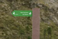
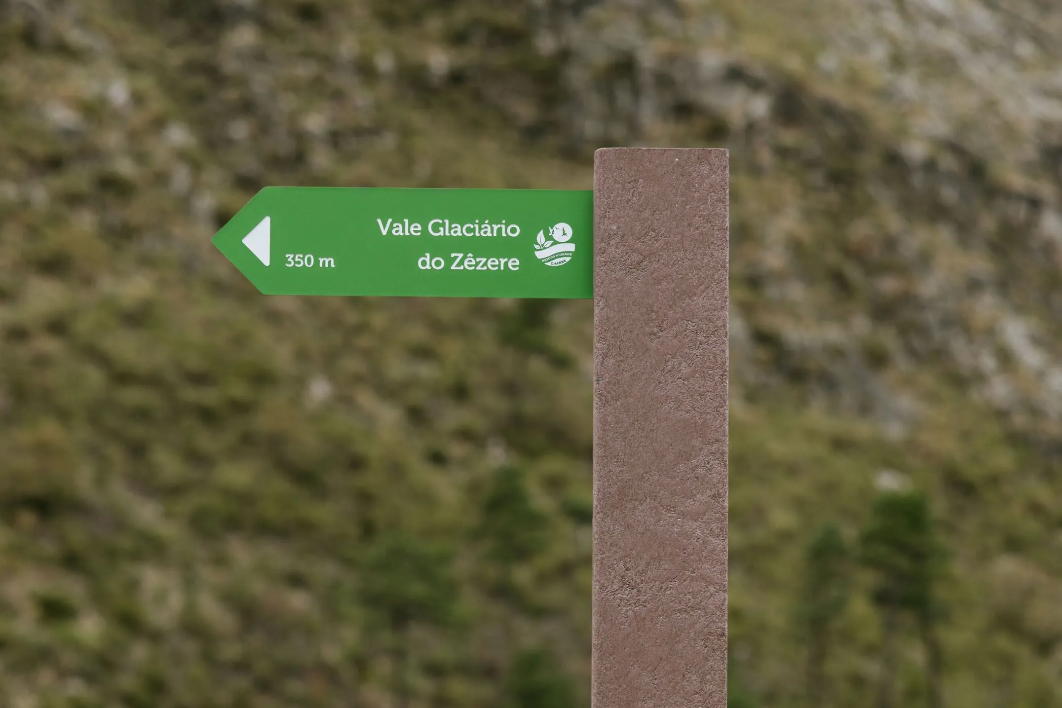
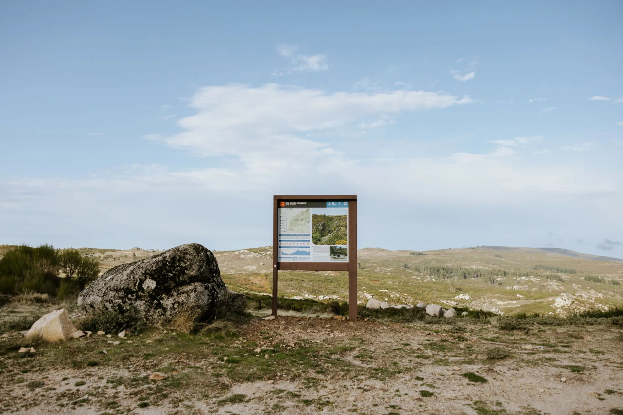
Directional signage structures interpretive routes and access to geosites, interpretation centres and points of interest.
ICNF posts and directional plates accompany paths, define junctions, indicate distances and reinforce safety in mountain environments. Their placement prioritises clear reading of routes and the reduction of off-trail trampling, contributing to the protection of vegetation and sensitive soils.
Form, scale and materials were defined to ensure resistance to frost, UV radiation, thermal variation and high-altitude winds, guaranteeing a discreet and permanent presence.
ICNF directional sign.
Reading the mountain and history
Interpretive signage
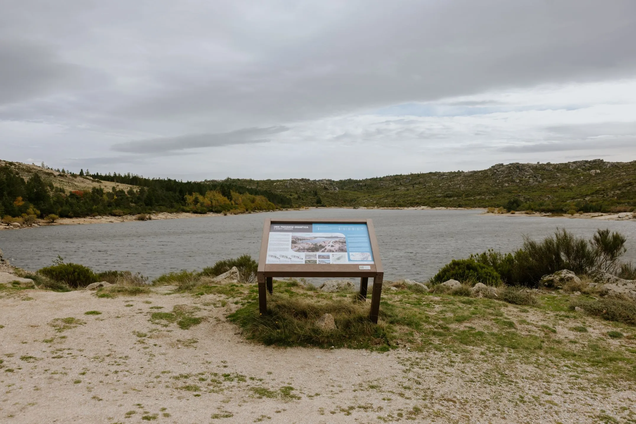
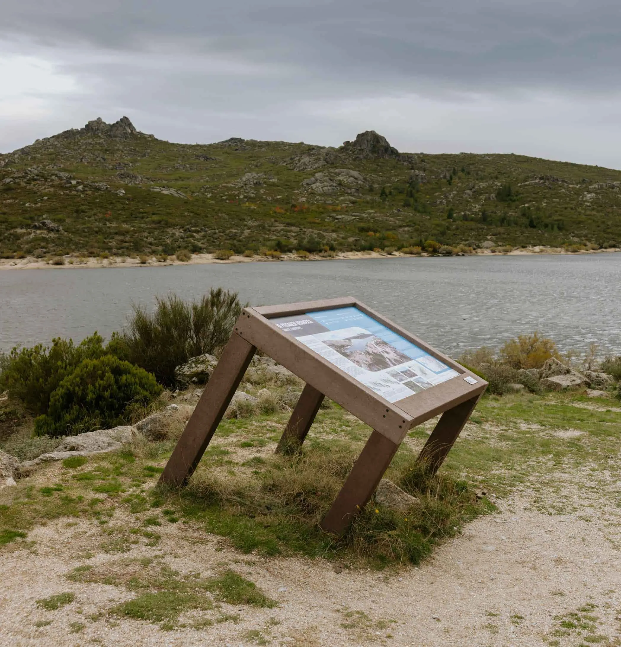
At geosites, viewpoints, interpretation centres and key territorial points, interpretive signage translates geological, ecological and historical processes into accessible language.
ICNF interpretive tables explain the origin of glacial valleys, the dynamics of ancient glaciers, endemic biodiversity, transhumance systems, megalithic remains and the evolution of human settlement.
These supports transform the territory into an open-air learning space — where each stop becomes a page in the great book of the Earth.
ICNF interpretive display
SMART signage
Organising and contextualising the experience
Informative signage
Informative signage structures routes by communicating maps, codes of conduct, protection rules, walking times and safety information.
Through ICNF information panels, responsible enjoyment is promoted, risk behaviours are prevented and environmental awareness is reinforced — essential in a territory where preservation also depends on visitor behaviour.
Large ICNF information panel.
Reading the landscape without impacting it
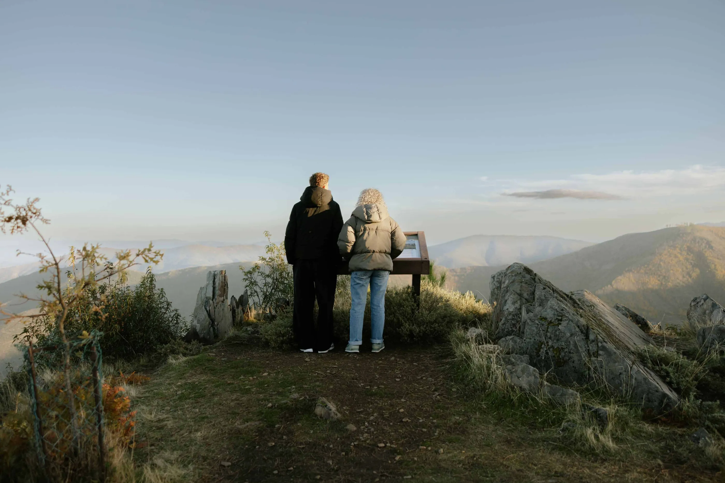
Viewpoints in recycled plastic
The construction of viewpoints must always take into account their impact on fragile ecosystems.
At strategic points across the territory, recycled-plastic viewpoints were developed — observation structures designed to allow contemplation of landscapes and glacial valleys without interfering with sensitive soils and habitats.
Recycled plastic was selected for its high durability, resistance to water, frost and UV radiation, and its maintenance-free performance, ensuring long-term structural and chromatic stability. These platforms create moments of pause, reading and contemplation, channelling visitor flows and preventing dispersion outside defined trails.

Recycled plastic viewpoint